SERVICES
Photography
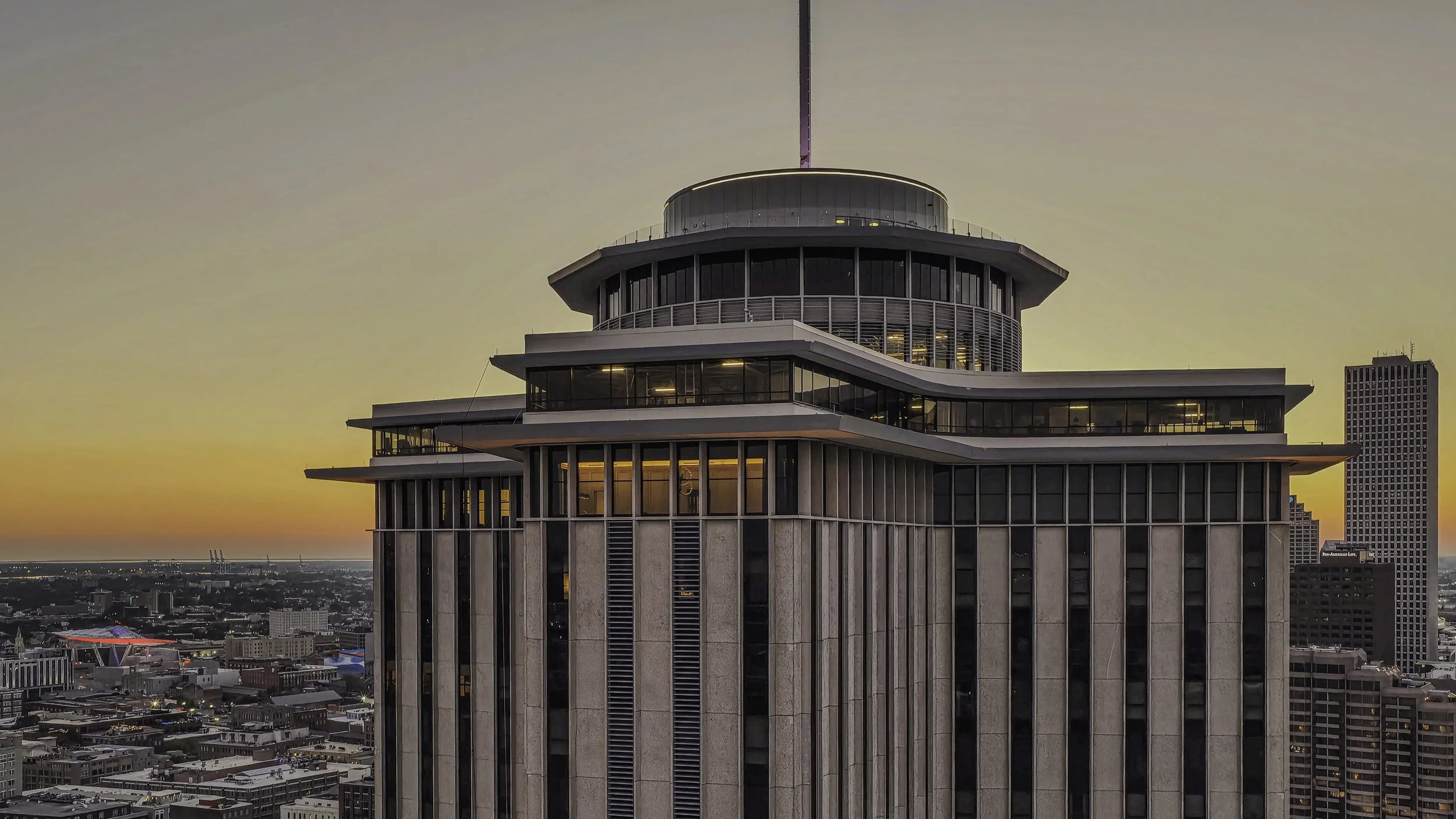
Our drone photography delivers crisp, high-resolution aerial images that showcase properties, events, and landscapes from a striking perspective. Perfect for real estate, commercial marketing, and documentation, our photos highlight scale, layout, and visual impact that ground-level cameras can’t capture.

Videography
Bring your project, event, or property to life with cinematic aerial video that captures movement, energy, and scale. Our drone videography delivers smooth, dynamic footage ideal for marketing, social media, and promotional content. Whether showcasing a development, vessel, or event, we create visuals that elevate your story.

Mapping
Our drone mapping services provide accurate orthomosaics, top-down views, and measurement-ready datasets for construction, land development, and environmental projects. Capture large areas quickly and safely with consistent, repeatable flights. Perfect for tracking progress, identifying changes, or generating detailed visual records.

Monitoring
Stay updated with ongoing aerial monitoring for construction sites, marine projects, environmental work, and commercial developments. Our scheduled drone flights create consistent visual milestones that help teams track progress, verify work, and improve reporting. Ideal for long-term projects that require clarity and accountability.

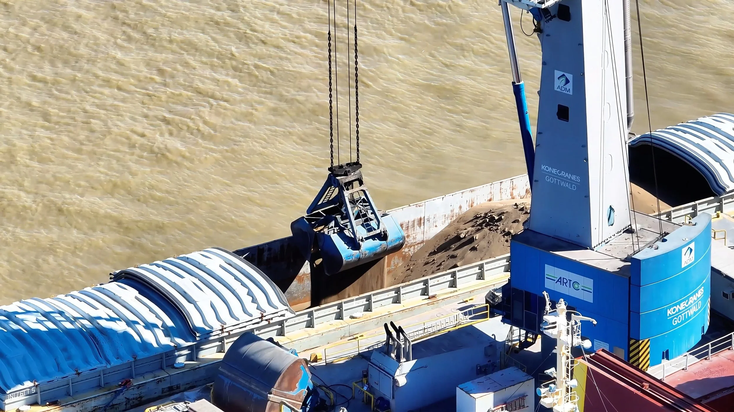
Inspections
We provide safe, high-resolution aerial inspections of roofs, structures, vessels, towers, and hard-to-reach assets—without the risk of ladders or lifts. Our drones capture detailed visuals that help identify damage, wear, and structural conditions quickly and efficiently. Perfect for insurance, maintenance, and industrial clients.

Virtual Tours
Give viewers an immersive experience with interactive virtual tours designed for real estate, commercial spaces, hospitality, and events. Our tours combine ground and aerial imagery to create a seamless, engaging walkthrough that highlights layout, features, and flow. Ideal for boosting online visibility and improving customer engagement.

Welcome to 504 Drone Imaging, where we bring cutting-edge technology and unparalleled expertise to enhance your visual storytelling and data collection needs.
Our Professional Services:
Photography: Our skilled pilots capture stunning aerial photographs that showcase your property, event, or project from unique and breathtaking perspectives. Whether it's real estate, construction, or special occasions, our high-resolution imagery adds a dynamic and compelling dimension to your visuals.
Videography: Elevate your storytelling with professional aerial videography. From sweeping cinematic shots to detailed flyovers, our footage adds a dynamic and engaging element to your videos. Perfect for promotional content, events, or showcasing your project in a way that traditional videography simply can't match.
Mapping: Precision meets efficiency with aerial mapping. Utilizing advanced technology and software, we create detailed and accurate maps for a variety of industries including agriculture, construction, and environmental monitoring. Stay ahead of the curve with our comprehensive mapping solutions.
Progress Monitoring: Keep your projects on track with progress monitoring. From construction sites to large-scale developments, we provide real-time aerial views, allowing you to monitor progress, identify potential issues, and make informed decisions to ensure successful project outcomes.
Inspections: Enhance the safety and efficiency of your inspections with drone technology. Whether it's infrastructure, buildings, or hard-to-reach areas, we provide detailed and high-resolution images, aiding in thorough assessments without the need for expensive and time-consuming manual inspections.
Virtual Tours: Immerse your audience in a virtual experience with our captivating 3D tours. Ideal for real estate, tourism, or showcasing architectural designs, our 3D tours provide an interactive and realistic exploration that leaves a lasting impression.
We also offer comprehensive Drone Consulting to any industry. Whether you're a novice, an enthusiast, a seasoned professional, or a business looking to integrate drone technology, our team of experienced consultants can guide you through every step of the process.
Why Choose 504 Drone Imaging?
Expertise: Our team of experienced pilots and technicians brings a wealth of knowledge to every project, ensuring optimal results.
Cutting-edge Technology: We utilize state-of-the-art equipment with the latest cameras and sensors to deliver top-notch quality and precision.
Safety First: Our commitment to safety is paramount. We adhere to industry best practices and regulations to ensure a secure and reliable outcome.
Custom Solutions: Every project is unique. We tailor our work to meet your specific needs, providing customized solutions that exceed expectations.
Transform your projects with the power of aerial technology. Contact us today to discuss how our aerial imaging solutions can elevate your visual storytelling, data collection, and project management to new heights.

Let’s Work Together!