


CONSTRUCTION
504DI, LLC | New Orleans, LA
Drone Construction Services:
Welcome to 504 Drone Imaging – Your Premier Partner in Drone Construction Services
At 504 Drone Imaging, we offer cutting-edge drone services designed to revolutionize the construction industry. Our advanced drone technology enables construction teams to streamline operations, improve safety, and optimize outcomes. Whether you're overseeing large-scale developments or smaller construction projects, our drone services provide a faster, more cost-effective, and more accurate solution. Embrace cutting-edge technology that enhances precision, safety, and productivity like never before. Invest in the future of construction today and experience unmatched efficiency, accuracy, and success.
From pre-planning to groundbreaking to ribbon cutting, drones streamline workflows and keep all parties in direct control of construction progress.
Our Drone Construction Services
Pre-Planning
Site analysis is essential to ensure the location is optimal for the proposed project. Visual data from drones is beneficial to understanding the overall layout, elevation, drainage
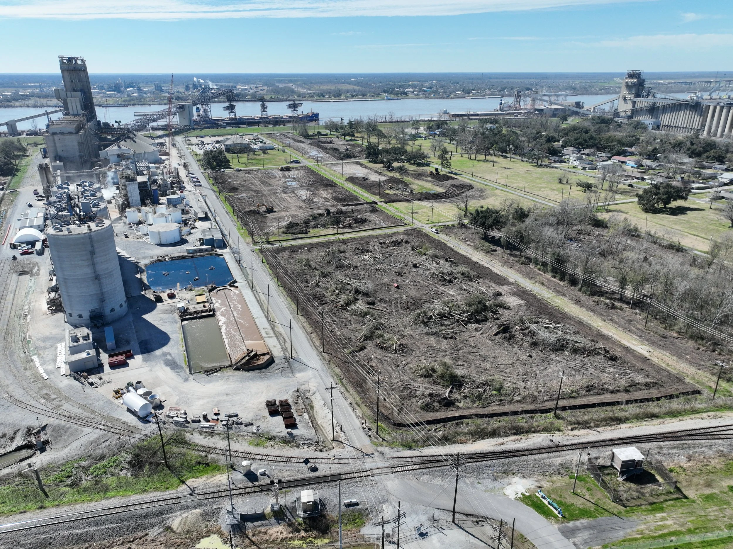
Aerial Site Surveying and Mapping
Gain a comprehensive view of your project with high-resolution aerial imagery and 3D mapping. Our drones can survey large areas quickly, capturing detailed data that can be used for topographical analysis, site planning, and construction progress monitoring.
Progress Monitoring & Reporting
Track your construction progress from a bird’s-eye view. Our drones provide real-time aerial footage and progress updates, helping you stay on top of milestones and project timelines. With visual data, you can improve stakeholder communication and make timely adjustments when necessary.
3D Modeling & BIM Integration
Integrate drone data into your Building Information Modeling (BIM) workflow for more accurate planning and execution. We use photogrammetry to generate precise 3D models of your construction site, allowing for better coordination and design verification.
Inspection & Safety Monitoring
Improve site safety with drone inspections. Our drones are equipped to inspect hard-to-reach areas, identify potential hazards, and monitor for safety compliance, all while minimizing worker risks. This ensures that your project adheres to industry safety standards while reducing downtime.
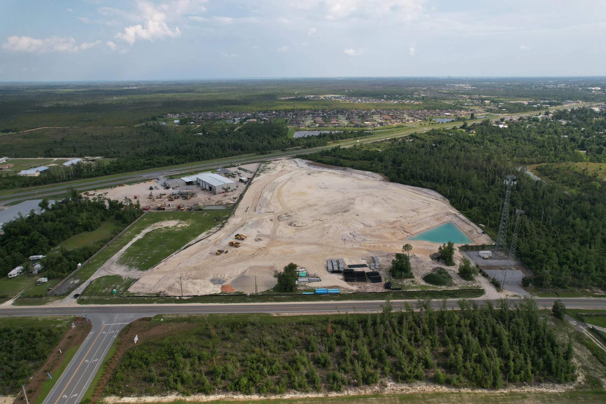
Volume Measurements
Accurately measure stockpiles and earthworks with our drone-enabled volumetric analysis. This service is ideal for calculating the volume of materials like soil, gravel, and aggregate, ensuring precise cost estimation and resource management.
Material & Logistics
Track incoming building materials and verify deliveries. Plan delivery routes by analyzing the condition of drop-off points. Produce daily inventory reports ensuring workers have needed materials.
Aerial Photography & Videography
Showcase your construction project with stunning aerial photography and videography. Whether you need marketing material, investor updates, or project documentation, our drones capture high-quality imagery that highlights the scale and progress of your work.


Why Choose 504 Drone Imaging?
State-of-the-Art Technology: We utilize the latest in drone technology to deliver reliable, precise, and fast results tailored to your construction needs.
Cost-Effective Solutions: Our drone services reduce the need for manual labor, expensive equipment, and extended timeframes, offering a more efficient alternative to traditional methods.
Certified Drone Pilots: Our team of certified and experienced drone pilots ensures that every flight is executed safely and complies with all industry regulations.
Customized Services: We understand that no two construction projects are the same. That’s why we offer flexible, customized solutions to meet your specific requirements.
Get in Touch: Ready to take your construction projects to new heights? Contact 504 Drone Imaging today for a consultation and learn how our drone services can enhance your next construction endeavor.


Drone Construction Services - New Orleans, LA
Servicing Baton Rouge, South LA and the Gulf South.

Learn More!