

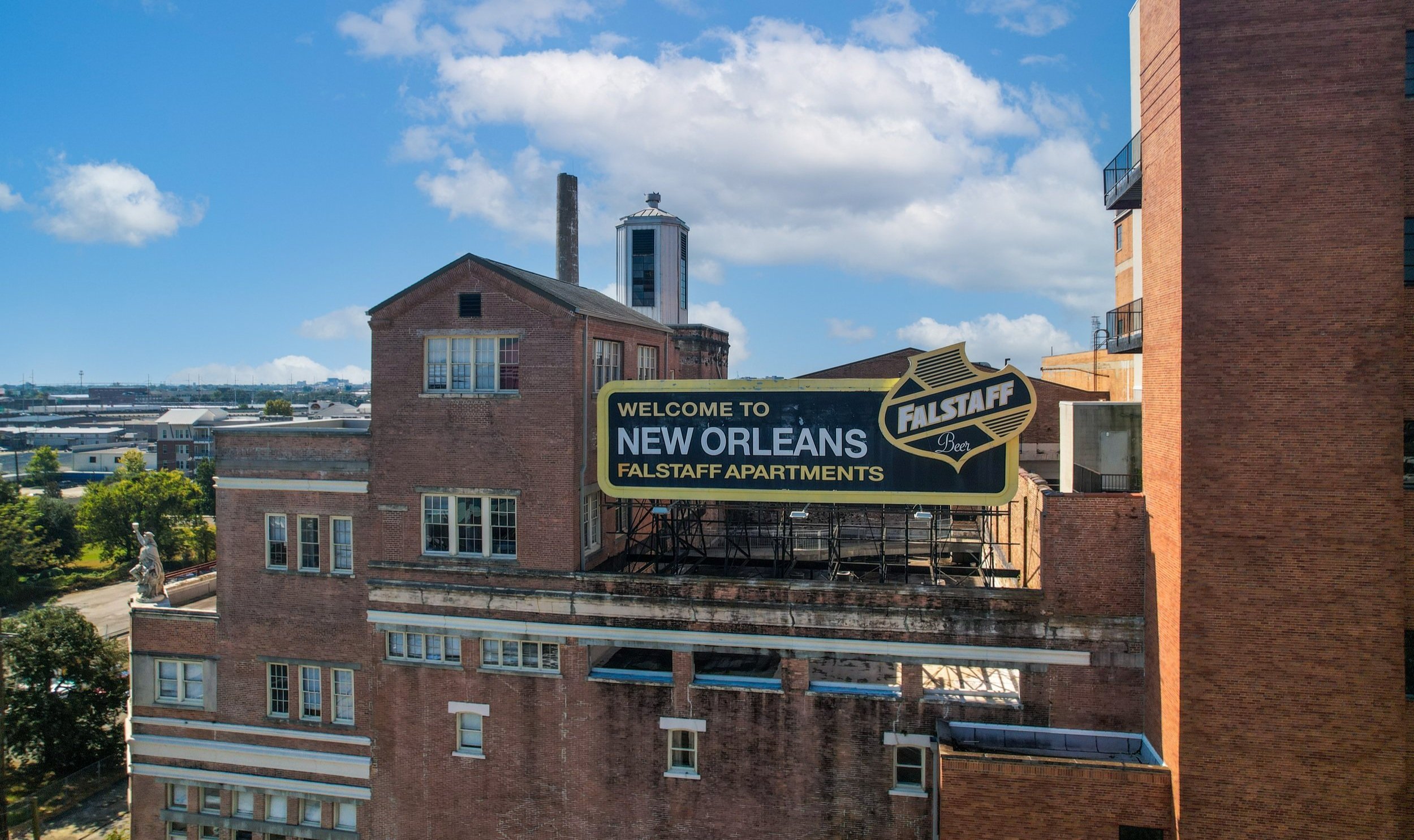
504 Drone Imaging, LLC | New Orleans, LA
DRONE MAPPING
Unlock Precise, Detailed Data with Cutting-Edge Technology
At 504 Drone Imaging, we specialize in delivering high-resolution aerial mapping solutions using state-of-the-art drone technology. Whether you’re in construction, agriculture, real estate, or land surveying, our mapping services provide you with accurate, comprehensive, and cost-effective data for better decision-making.
Drone Mapping is the use of unmanned aerial vehicles (UAVs) to collect aerial data and generate maps, models, and other types of visual representations of a worksite.
Designed to cater to professionals across industries, from construction companies, developers, contractors, land surveyors, environmentalists, and urban planners, we can take your project to soaring heights, delivering unmatched accuracy, speed, and versatility.
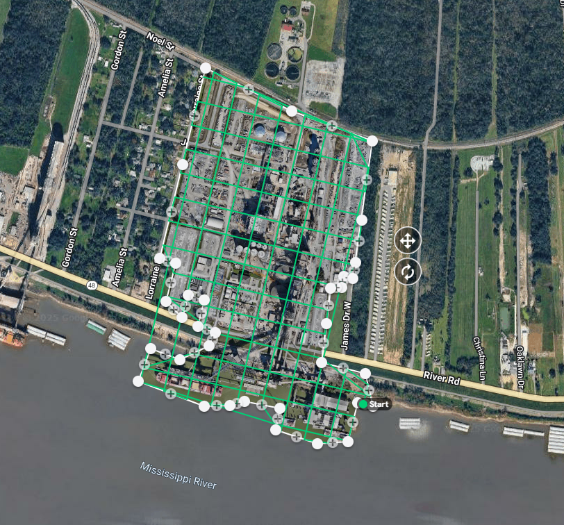
Mapping technology is revolutionizing industries by offering a faster, more flexible, and cost-efficient alternative to traditional surveying methods. With drones, we capture high-quality aerial images and convert them into precise 2D maps and 3D models, giving you the insights you need to understand terrain, structures, and landscapes with unmatched accuracy.

Our Mapping Services
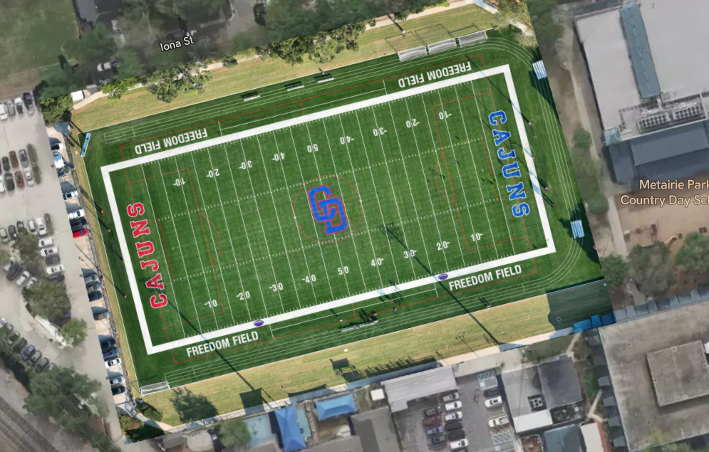
Orthomosaic Mapping
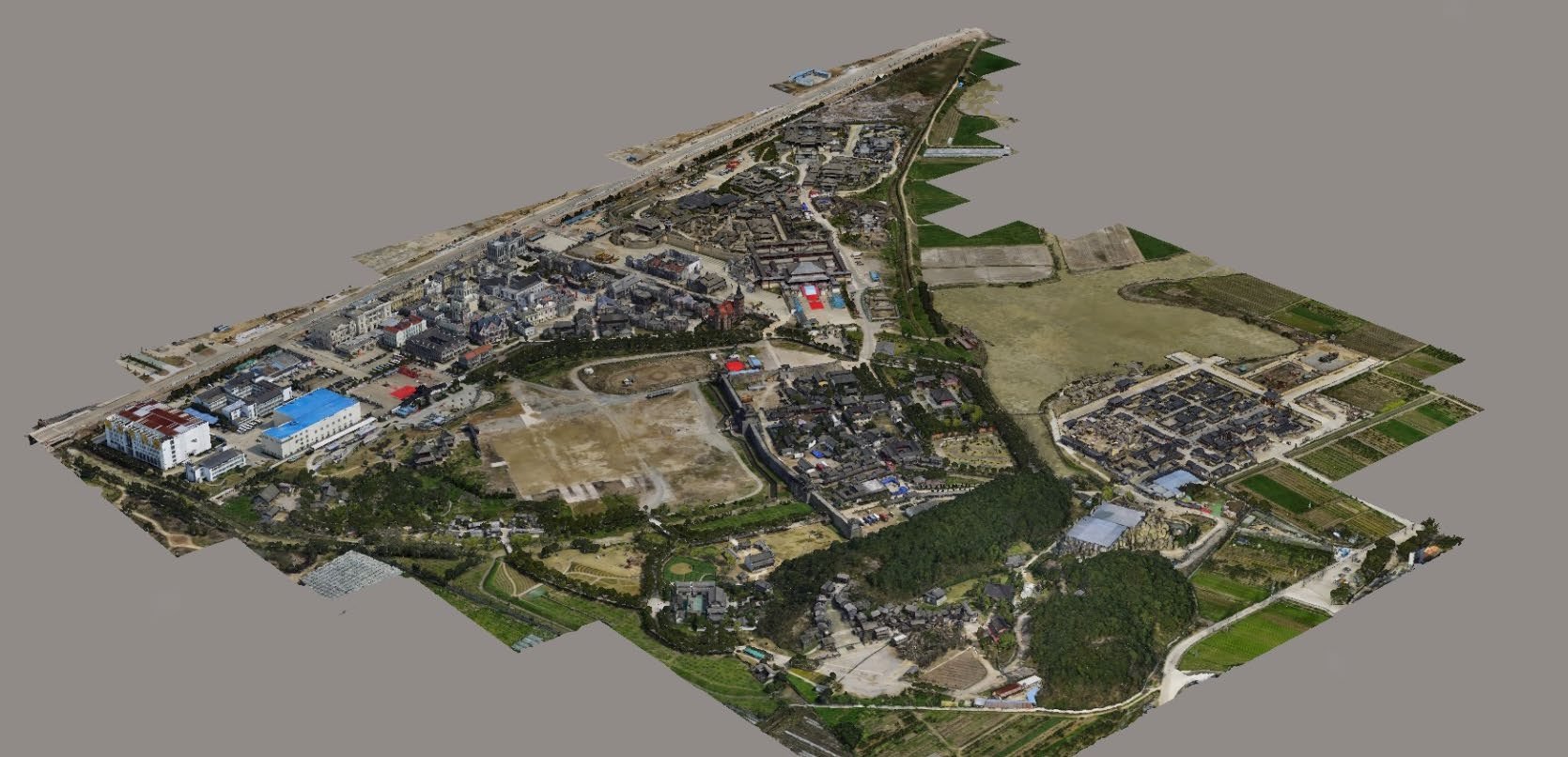
Generate accurate, geo-referenced, and detailed 2D and 3D maps that are ideal for site planning, inspection, and progress monitoring.Topographic Mapping
Get high-resolution 2D and 3D maps that showcase elevation data and terrain models. Perfect for construction, environmental studies, and land development.Volumetric Analysis
Accurately calculate stockpile volumes, material quantities, and more. Save time and reduce errors compared to traditional techniques.Land Surveying
Efficiently capture large areas of land in a fraction of the time. Our aerial mapping provides accurate measurements and visualizations for construction projects, property boundaries, and urban planning.Agricultural Mapping
Monitor crop health, analyze irrigation needs, and optimize land use with drone-based aerial mapping. Make informed decisions to boost productivity and yield.

Industries We Serve:
Construction & Development
Track site progress, perform earthwork calculations, and monitor changes over time with detailed 2D and 3D maps and models.Real Estate
Present property layouts, understand land contours, and showcase large plots with detailed and visually appealing maps.Agriculture
Use precision mapping to analyze crop health, optimize irrigation, and monitor growth, helping you increase efficiency and yields.Environmental Studies
Conduct environmental assessments, monitor deforestation, and study land use changes with accurate, up-to-date aerial data.

ADVANTAGES AND BENEFITS OF DRONE MAPPING
Versatility Across Industries: Our services cater to a wide range of industries. From real estate professionals to construction companies ensuring project progress stays on track, or agriculture businesses requiring precise crop analysis. Our versatile solutions fit various needs.
Enhanced Project Planning: Make smarter decisions from the start with accurate orthomosaic maps and models. Streamline project planning and reduce potential risks, all while optimizing resource allocation for better efficiency.
Improved Communication: Our visually engaging maps and models make it easier to communicate complex ideas and concepts to stakeholders. Whether you're presenting to clients, investors, or your team, compelling visual aids leave a lasting impression.
Provides high-resolution aerial data that is more accurate and detailed than traditional mapping methods. This increased accuracy can lead to better decision-making and more informed planning and analysis.
Eliminates the need for manual data collection, and provides real-time data that can be processed and analyzed quickly. This saves time and resources compared to traditional survey methods.
Access to areas that are difficult or impossible for humans to reach, such as high-rise buildings, dense forests, or dangerous disaster zones. This allows for data collection and mapping in places that were previously inaccessible.
Eliminates the need for expensive equipment and reduces the need for large teams of surveyors.
Drone mapping eliminates the need for people to work in dangerous or hazardous environments, improving safety and reducing the risk of injury or harm.
Learn More: Read our Blog Post; A Beginners Guide to Drone Photogrammetry: Unlocking the Power of Aerial Mapping.
Why Choose 504 Drone Imaging?
State-of-the-Art Equipment
We use the latest in drone and mapping technology to capture precise and high-quality data, ensuring your project gets the best results.Expertise
Our team of certified drone pilots and mapping specialists bring years of experience in delivering top-tier aerial mapping services across multiple industries.Fast Turnaround
Get your data quickly, so you can make timely decisions and keep your projects on track.Cost-Efficiency
By using drones, we minimize the time and resources needed for data collection, providing you with a more affordable solution without compromising quality.
Get Started Today!
Transform the way you gather data with 504 Drone Imaging’s drone mapping services. Contact us today to discuss your project needs, and discover how we can help you achieve more with precise, efficient, and cost-effective mapping solutions.


Drone Mapping - New Orleans, LA
Servicing Baton Rouge, South LA and the Gulf South.

Let’s Fly Together!