
How Drones Monitor and Help Battle Coastal Erosion
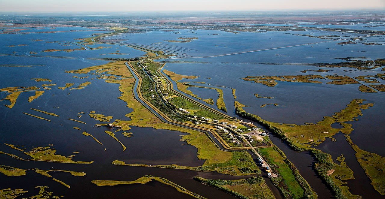
Introduction: Coastal erosion is a critical environmental challenge affecting communities worldwide. Southeast Louisiana has lost a large portion of its wetlands and is expected to lose more in the coming years, with some estimates claiming wetland losses equivalent to up to one football field per hour. One consequence of coastal erosion is an increased vulnerability to hurricane storm surges, which affects the New Orleans metropolitan area and other communities in the region. As our shorelines face the relentless forces of nature and human activity, innovative solutions are emerging to combat this issue. One such groundbreaking technology making waves in coastal conservation is the use of drones. In this blog post, we'll explore how drones are being employed to monitor and mitigate coastal erosion, offering a new perspective on safeguarding our precious coastlines.
A Bird's Eye View: Drone Surveillance in Coastal Areas: Drones, equipped with high-resolution cameras and advanced sensors, provide a bird's eye view of coastal regions. This aerial perspective allows researchers and environmentalists to assess erosion patterns, identify vulnerable areas, and track changes over time. The real-time data gathered by drones enables a more accurate understanding of the dynamics at play, laying the groundwork for effective erosion management strategies.
Mapping the Changes: GIS Technology and Coastal Erosion: Geographic Information System (GIS) technology, integrated with drone data, plays a crucial role in mapping coastal erosion. Drones capture detailed imagery, and GIS tools process this information to create comprehensive maps illustrating erosion-prone zones. These maps serve as valuable resources for coastal planners, helping them make informed decisions on land use and development while prioritizing areas in need of protection.
Precision in Action: Drones for Coastal Monitoring: The agility and precision of drones make them ideal for monitoring hard-to-reach coastal areas. Drones can navigate rugged terrains and inaccessible locations, providing a level of detail that traditional monitoring methods often lack. This enhanced precision allows for targeted interventions, ensuring that resources are allocated efficiently to address the most critical erosion hotspots.
Early Warning Systems: Drones for Predictive Analysis: Drones equipped with cutting-edge technology, such as thermal imaging and LiDAR, can detect subtle changes in coastal conditions that may precede significant erosion events. This capability transforms drones into early warning systems, enabling proactive measures to be taken before irreversible damage occurs. Timely interventions can include the placement of barriers, vegetation restoration, or the implementation of other erosion control methods.
Eco-Friendly Rehabilitation: Drones in Coastal Restoration: Beyond monitoring, drones are actively contributing to coastal restoration efforts. Afforestation and the planting of vegetation play a crucial role in stabilizing coastlines. Drones are used to disperse seeds or plant saplings in areas identified as high-risk for erosion. This eco-friendly approach to rehabilitation minimizes the environmental impact while fostering the growth of natural barriers against erosion.
Challenges and Opportunities: The Future of Drones in Coastal Conservation: While drones present a promising frontier in the fight against coastal erosion, there are challenges to address. These include regulatory considerations, data privacy issues, and the need for continued technological advancements. As the technology evolves, however, the opportunities for effective coastal conservation through drone usage are vast and continually expanding.
Conclusion: Drones are proving to be indispensable tools in the battle against coastal erosion. From detailed monitoring and mapping to predictive analysis and rehabilitation efforts, these unmanned aerial vehicles are revolutionizing the way we approach coastal conservation. As we navigate the challenges of our changing environment, the integration of drone technology offers a beacon of hope for the preservation and protection of our precious coastlines.