
How Drones are Revolutionizing Real Estate Development
Introduction: The real estate development industry has always been marked by challenges, from site assessment to construction management. However, with the rapid advancement of technology, particularly in the realm of drones, a new era of solutions is emerging. In this blog post, we will explore some of the top challenges faced by real estate developers and delve into how drones are poised to alleviate these issues.
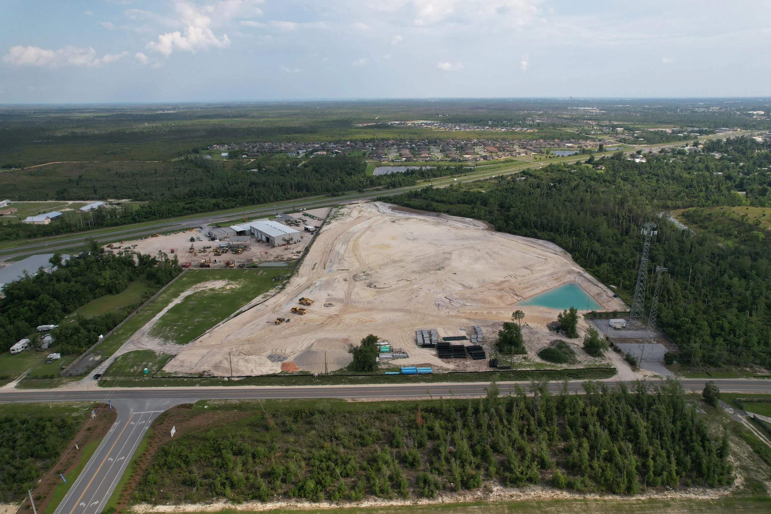
Site Surveying and Mapping: One of the initial hurdles in real estate development is the accurate assessment of the construction site. Traditional methods involve manual surveying, which is time-consuming and often prone to errors. Drones equipped with high-resolution cameras and LiDAR technology can swiftly and precisely map the terrain, providing developers with detailed 3D models and topographical data. This streamlines the planning phase, reduces costs, and minimizes the likelihood of unexpected obstacles during construction.
Project Monitoring and Documentation: Monitoring construction progress and documenting changes on a large site can be challenging. Drones offer a bird's-eye view of the entire project, capturing high-resolution images and videos at regular intervals. This not only aids in tracking construction milestones but also serves as a valuable tool for project documentation and reporting. Real-time data from drone surveys allows developers to identify and address issues promptly, preventing potential delays.
Safety Inspections: Safety is paramount in construction, and regular inspections are essential to identify potential hazards. Drones equipped with thermal imaging cameras and sensors can conduct aerial inspections of construction sites, identifying safety risks such as faulty wiring or structural weaknesses. This not only enhances safety protocols but also reduces the need for manual inspections, minimizing the exposure of personnel to potentially dangerous situations.
Environmental Impact Assessment: Real estate development projects must adhere to environmental regulations, which often require thorough assessments of the project's impact on the surrounding ecosystem. Drones provide a non-intrusive means of monitoring environmental changes, allowing developers to assess the impact on wildlife, vegetation, and water bodies. This data aids in making informed decisions to mitigate any adverse effects, ensuring compliance with environmental regulations.
Marketing and Visualization: Presenting a project to potential investors or buyers often relies on visually appealing representations. Drones equipped with high-quality cameras can capture stunning aerial footage, showcasing the entire development in a way that traditional methods cannot. This immersive visual content can be used for marketing purposes, attracting investors and buyers by providing a comprehensive view of the property and its surroundings.
Conclusion: As the real estate development industry grapples with various challenges, drones emerge as a powerful tool capable of transforming the way projects are planned, executed, and marketed. The integration of drone technology not only improves efficiency and accuracy but also enhances safety measures and environmental considerations. As we move forward, the partnership between real estate developers and drones is set to redefine the landscape of the industry, paving the way for innovative, sustainable, and visually captivating developments.