

A Beginner's Guide to Drone Photogrammetry: Unlocking the Power of Aerial Mapping
Introduction: In recent years, the integration of drones into various industries has opened up exciting possibilities, and one of the most promising applications is drone photogrammetry. This innovative technology allows businesses to create highly accurate 3D models and maps by capturing aerial images. In this beginner's guide, we'll explore the basics of drone photogrammetry and how it can revolutionize your professional services.
Understanding Drone Photogrammetry:
What is Drone Photogrammetry?
Drone photogrammetry involves using a drone equipped with a camera to capture a series of overlapping images of a specific area. These images are then processed using specialized software to create detailed and accurate 3D models or maps. The process relies on the principles of photogrammetry, which measures distances and angles from photographs.
Key Components of Drone Photogrammetry:
Drone Platform: Choose a drone with a high-quality camera and the ability to cover the desired area efficiently. Some popular choices include DJI Phantom series or the DJI Mavic series.
Camera Settings: Adjust camera settings such as shutter speed, ISO, and aperture to ensure optimal image quality. A high-resolution camera is crucial for capturing detailed images.
Ground Control Points (GCPs): These are physical markers on the ground with known coordinates. GCPs help improve the accuracy of the final model by providing reference points during processing.
Steps to Conduct Drone Photogrammetry:
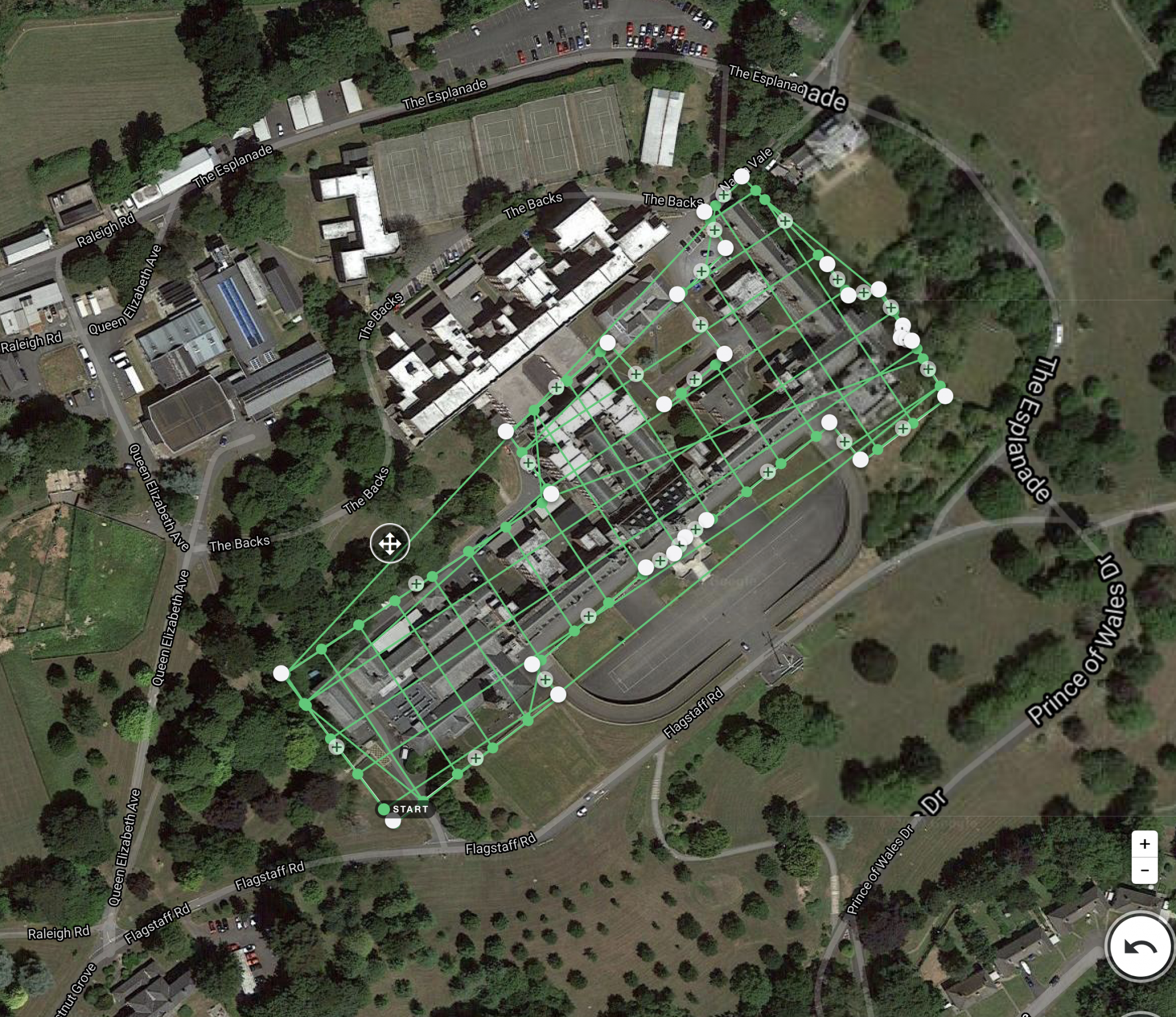
1. Mission Planning:
Before takeoff, plan your drone mission using specialized software like Pix4D or DroneDeploy. Define the survey area, altitude, and image overlap to ensure comprehensive coverage.
2. Pre-flight Check:
Ensure your drone is in optimal condition. Check the battery, propellers, and GPS signal. Verify that the camera settings are configured for the specific conditions of your survey.
3. Image Capture:
Fly the drone over the designated area, capturing a series of high-resolution images with significant overlap. This overlap is crucial for accurate photogrammetric processing.
4. Post-processing:
Transfer the captured images to your computer and use photogrammetry software to stitch them together and create a 3D model. Adjust settings and include GCPs for improved accuracy.
5. Analysis and Application:
Once the 3D model is generated, analyze the data for your specific application. Drone photogrammetry finds applications in various industries, including construction, agriculture, environmental monitoring, and surveying.
Benefits of Drone Photogrammetry:
Cost-Effective Mapping: Drone photogrammetry eliminates the need for expensive traditional surveying methods, making it a more cost-effective solution.
Rapid Data Collection: Drones can cover large areas quickly, enabling faster data collection and processing times compared to traditional methods.
Accurate and Detailed Models: The technology produces highly accurate and detailed 3D models, providing valuable insights for decision-making.
Conclusion:
Embracing drone photogrammetry can revolutionize your professional services by providing accurate and efficient mapping solutions. As technology continues to advance, integrating drones into your workflow can give you a competitive edge in various industries. Stay ahead of the curve and explore the endless possibilities of aerial mapping with drone photogrammetry.